Reports that keep up
Reports and deliverables update automatically when new information is added. Every change is cited and marked for review.

Your files hold the answer. Statvis gives that knowledge back to you, along with a defensible path to closure, faster than you think possible.
How contaminated sites get managed today
Staff leave and consultants rotate, but the site file stays. Statvis reads all of it, keeps what it learns, and builds on it every time a new report, lab certificate or regulator letter arrives.
Reports and deliverables update automatically when new information is added. Every change is cited and marked for review.
Rank your site portfolio for action on actual facts and data, not assumptions, and re-run it whenever documents or guidelines change.
Instant decision support that any team member can use, from the site lead to the new hire, without a review team.
Tell a site's story in a way every audience can move forward from.
Site history
Drop in decades of site files. Statvis reads every page, finds every event and dates it, then answers your questions with the exact passage it came from.
Site assessment
Pull records from public registries, pin old site plans to the map, outline every area of concern found in your reports and measure the distance to every river and water well.
Mapping
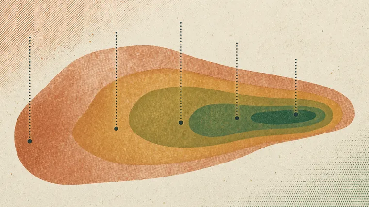
Interpolate every layer and see the plume in 3D. Draw a line for a cross-section, calculate contaminated volumes layer by layer, and test every well for a trend.
Mapping →Forensics
Generic guidelines often overstate risk. Chemical fingerprinting separates sources and background, sample by sample, and builds the evidence for a site-specific, risk-based approach.
Reporting
Exceedance tables formatted and ready for the report. Standard figures built from live site data in one click.
Reporting →Portfolio
Rank every site by priority, each score built from that site's own data and documents. Know where to spend first.
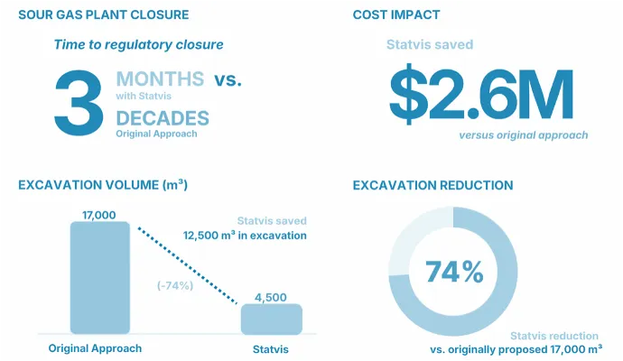
Case study · Sour gas plant closure
The original plan
17,000 m³ of soil to dig up, and years of additional soil and groundwater sampling.
What the record showed
Salinity fingerprints in the site's own historical data matched naturally occurring background, so the guidelines were adjusted to site conditions.
The approved plan
Statvis was designed by environmental scientists, forensic chemists and software engineers who have spent decades on closure plans, regulatory files and litigation. It speaks your language, whichever side of the site you sit on.

Take control of your portfolio.
Hundreds of sites, one clear view of liability, and answers for leadership, regulators and transactions.
For site owners →
Take control of your projects.
Onboard a new site's full history in hours, not weeks, and bill it to the project, not to overhead.
For consultants →
Take control of your case files.
Every claim traced to a document, page and passage that opposing counsel can follow back to the record.
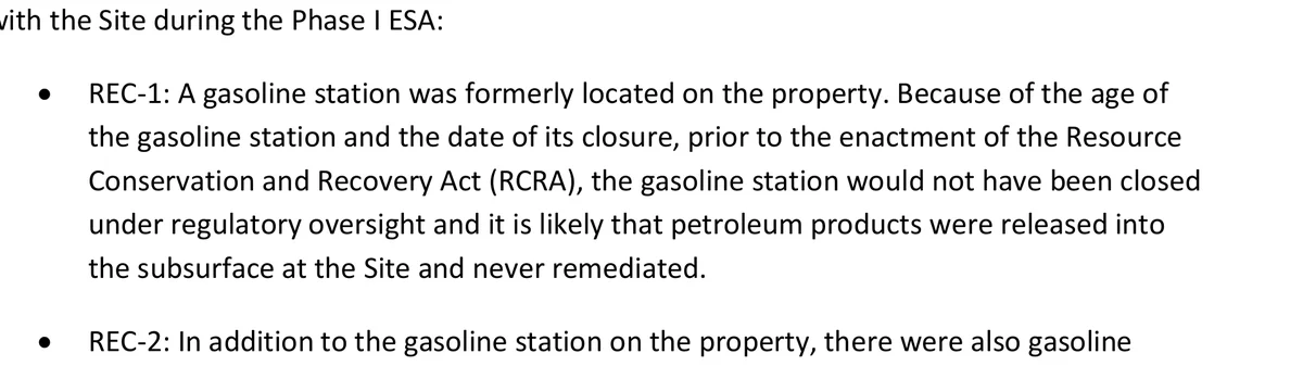
For legal teams →Most AI tools cite a document, if anything. Statvis cites the passage, boxed on the page, one click from the answer. It searches the whole record, not the first ten matches.
The assessment found it likely that petroleum products were released into the subsurface and never remediated.
The same answer, cited three ways
DocumentPhase I ESA.pdf
93 pages to check
PagePhase I ESA, page 9
1 page to read
Passage · StatvisPhase I ESA, p. 9, REC-1
2 sentences to verify
Statvis is priced per project, whether that's a site, a file or a matter, so it bills to the work it supports.
A living, cited knowledge base for each site.
The scientists who built Statvis, for the sites that need more than software.
For owners with dozens or hundreds of sites.
Bring us one site's documents. We'll show you what's in them.