
Statvis has introduced an automated interpolation system that removes guesswork from spatial data analysis. The platform optimizes parameter selection for methods like inverse distance weighted, p-spline, and kriging, enabling users to generate consistent, defensible maps without extensive technical expertise.
Sample Similarity Interpolation
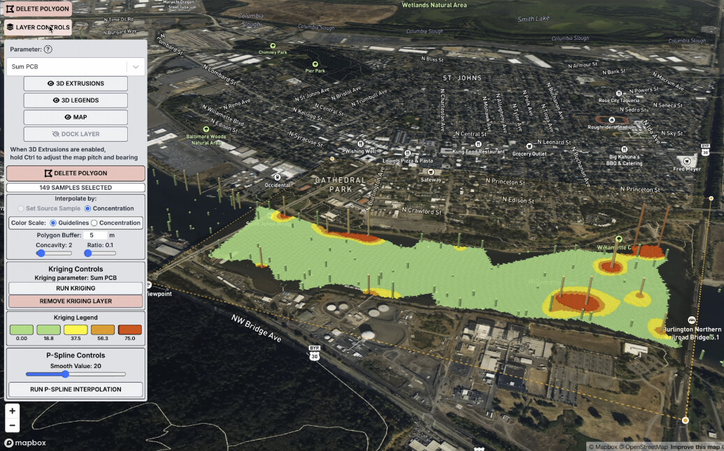
Our proprietary innovation allows interpolation based on sample similarity rather than just concentration thresholds. This approach proves particularly valuable for environmental plume delineation, as it can distinguish between multiple contamination sources in overlapping areas.
The workflow is straightforward: just select a group of samples and click run.
This simplification addresses a persistent challenge in geostatistics where interpolation requires significant technical judgment. The technique supports fingerprinting applications and chemical analysis, enabling users to master their data instead of wrestling with it.